STUDENTS AND ALUMNI ABOUT UNIGIS
UNIGIS Students, most of whom are professionals when they start UNIGIS, have diverse backgrounds. To name just a few: defence, engineering, banking, environmental management, health care, ICT. The Netherlands' Cadastre, Land and Mapping Agency (Kadaster) is one such employer who encourages their professionals to engage with UNIGIS. In the past 22 years about 15 Kadaster professionals started to study the UNIGIS program. We recently talked to three of them, Joris Hoogenboom, Viola de Lange and Vincent van Altena.
Further, we share with you some experiences from students who have completed the UNIGIS program somewhat longer ago: Paul Jonk, Marten Hogeweg and Paulus Dorlas.
| |
Smart Mobility, GIS and traffic data |
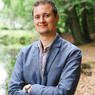 |
Joris Hoogenboom (1986) studied Civil Engineering and works for almost 5 years at BonoTraffics as traffic engineer specialized in modeling and simulating traffic flows. He started UNIGIS in September 2013 and, due to the demand for projects and product development at his job, he is now halfway his first study year. "I experience that the amount of traffic data is increasing. For costumers, like governments, it becomes more difficult to distract or combine the right GIS data. Due to the study it is easier for me to understand other specialisms, to integrate data from different sources and to come to the right conclusions." Studying at UNIGIS helps him to apply specific theory on traffic data and while working with IT-partners, he brings in tools to bridge the gap between disciplines. |
"In Smart Mobility you will notice two major technological developments: the autonomous and cooperative vehicles. Both have the intention to increase safety, a sustainable environment and a better traffic flow. Smart Mobility is only possible with an excellent combination of data. Therefore it is needed that knowledge on data is understood and shared."
"Living in a world in which data is increasingly available to all kinds of people and companies, it is important to have knowledge and notion on how to use these data wisely. With all development on infrastructure and changes in privacy policy it makes it interesting to work in this field. It will be necessary to have an answer to the need of appliance of data in different disciplines."
Joris enjoys the practicums on database management, the yearly workshops and the wide range of students best in his study. He suggests UNIGIS keeps focused on the application of the theory. |
|
| |
Motivation is key |
 |
Viola de Lange (1980) started her program in September 2013 and successfully finished her first study year. If she hadn't been expecting twins this spring, she would be continuing with the rest of the program because the themes of the second year appeal to her. In her current job as a Project Manager GBKN (Large Scale Standard Map of The Netherlands), she benefited from the modules that intersected very well with her daily work.
Studying while working enhances career perspectives, Viola argues. "This certificate not only is a valuable asset on my CV, it also allows me to provide more solid and founded feedback during my work." |
To avoid study delays, Viola recommends other students to closely work together. She was lucky to have close contact via What's App with two fellow students. They motivated each other and progressed through the programme together. She therefore suggests UNIGIS tutors to engage more with their students and to encourage collaborations, in order to keep students motivated. |
|
| |
Directly applying in-depth research |
 |
Vincent van Altena (1977) started UNIGIS in 2008 and graduated with high merit in January 2015 on the topic of automatic generalization of manmade water networks. He has been working at Kadaster since 1999, having completed his Theology. His intentions back then were to work at Kadaster briefly and enroll in a mastersprogramme as soon as possible.But life plans changed and Vincent developed a GIS career at Kadaster.
His work has evolved from digitalization, scanning and cartography to customized GIS analyses for a variety of customers. He currently works on automatic generalization of topographic data, such as the TOP50NL, European Location Framework and the Top10 the BbasemMap for the publicly available PDOK web map service. |
His thesis allowed Vincent to dig deeper into the algorithms needed to generate good water network maps. These algorithms existed, but only for natural water networks and not for manmade networks as present in the Netherlands. His research resulted in a better method to identify the structure of a network and to tailor the thinning algorithm accordingly.
Vincent agrees with Viola that there are many opportunities for UNIGIS to engage more with their students. He thinks the upcoming webinars are a good start. Recommendation to UNIGIS? He missed facilitated interaction moments with his fellow students during his study years and he is happy to see that UNIGIS is taking up the challenge of modernizing the content of the study program. |
|
| |
Certificate, Nice; Diploma, Great; MSc... Awesome |
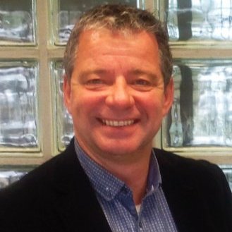 |
"I have given the last couple of years to Unigis; But what a joy. Unigis not only enriched me with Geo-related knowledge but also provided me personally with a more analytical view and changed me somehow in that matter in a positive way. The long distance learning method Unigis uses encouraged my enthusiasm of GIS and was the only way for me to combine my professional live with the academic one.
Great respect goes to the staff of Unigis Amsterdam (and Manchester Metropolitan U.) who accompanied me with great support to become a Harry Potter-like MSc (That's the way UK dresses up for graduation). The whole crew has a warm family-like approach of coaching their students. Always available and sharp when it's necessary. So a warm "Thank you" and a big hand goes to Unigis for giving me that Unigis-feeling and feeding my never-ending educational GIS-appetite." |
Paul Jonk, Masterís student |
|
| |
UNIGIS changed my carreer and personal life |
 |
"I had been working in GIS for a while, performing flood damage assessments, but I could not have foreseen that taking a course like this would change my career and my personal life in the way it did. Just after completing the diploma part and starting work on ideas for the Masterís thesis, I joined ESRI Netherlands. Doing the thesis was fun. I spent many hours searching the web for ideas, digging up research material and translating it into a coherent document based upon some analysis of my own. Joining ESRI has proven to be a very valuable step, both professionally and socially. GIS provided a solid foundation for this exploration and I want to thank all those who helped me develop the skills I possess today." |
Marten Hogeweg, Masterís student |
|
| |
UNIGIS offered me the right knowledge at the right moment |
"The UNIGIS programme is one of the first to qualify for European accreditation; this means that the Diploma and the Masters Degree will be officially internationally recognized. The programme helped me enormously during my work placement in Guinea. I was always able to use the knowledge I needed Ė about database development, for example Ė at the right moment. For me, the most important part of the course was managing the introduction of a GIS system, as this allows you to learn the key elements in the process of change, in gathering data and in keeping it up to date.
Back in the Netherlands, I learned a lot about databases and the use of computers and the Internet. As a result, I now attach much less value to software; what is really important is the way computers are used. I no longer allow myself to be taken in by tall tales of endless possibilities. Just show me how we persuade people to sit at the computer and take part in the development of a particular program." |
Paulus Dorlas, Masterís student |
|
|


