The SPINlab carries out research on geo-information sciences and spatial information management. We apply a wide range of spatial analysis methods and techniques on a broad range of research topics. Depending on the topic at hand, our focus lies on one or more of the following aspects of the data science process:
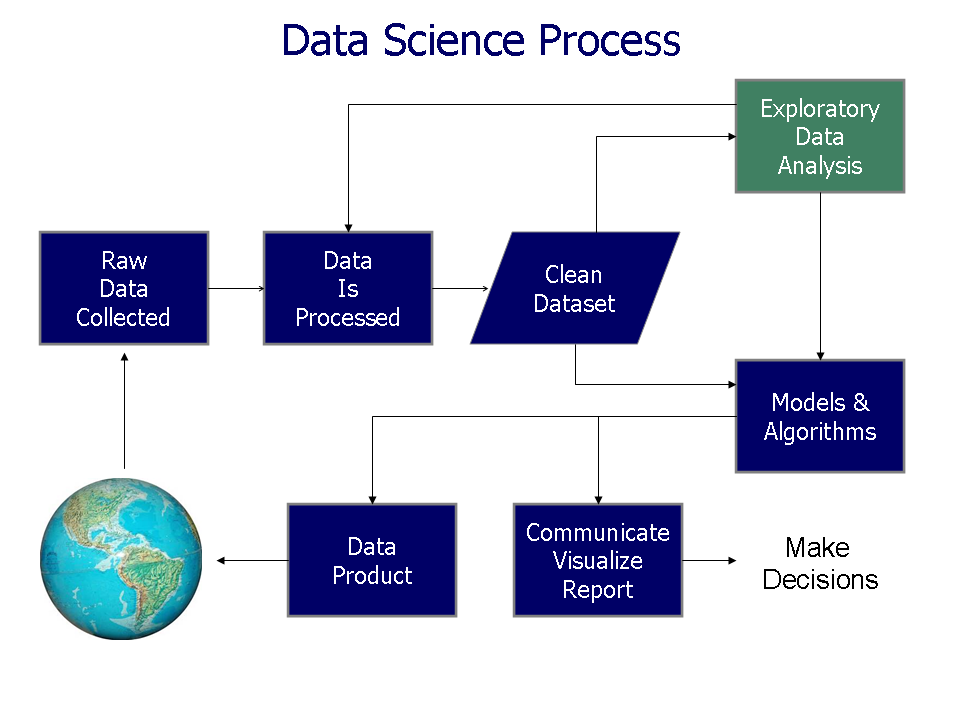
- Data collection & preparation
- Spatial Analysis
(from exploratory analysis to explanatory modelling) - Visualisation & Communication
(static maps, interactive (web) maps & graphs, infographics)
Our research activities can be grouped in several thematic and methodological themes:
The research is funded through the Netherlands Organisation for Scientific Research (NWO), Dutch science programmes such as Climate changes spatial planning and Knowledge for climate, the European Commission, Dutch Ministries and other external organisations. Research is carried out by PhD students and permanent staff.
Information on older project can be found here.