Exchange and Research Cooperation Rijkswaterstaat and SPINlab
Rijkswaterstaat (RWS) is part of the Dutch Ministry of Infrastructure and the Environment and is responsible for the design, construction, management and maintenance of the main infrastructure facilities in the Netherlands. This includes the main road network, the main waterway network and watersystems.
RWS and the SPINlab have started a knowledge exchange and research cooperation in May 2015, based on Spatial Information Technologies. The collaboration concerns jointly setting up long- and short-term research projects, wherein RWS and SPINlab work closely together. It also concerns organising innovative knowledge exchange sessions on a specific subject for professionals and those who take an interest in the subject it concerns.
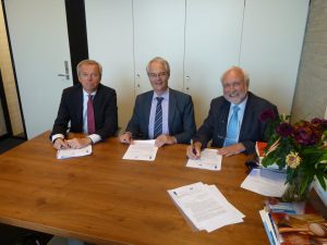
On 22 May 2015 the Faculty of Economics and Business Administration (where the SPINlab is part of) has signed a Framework Agreement with Rijkswaterstaat (RWS) for four years. This knowledge exchange and research cooperation is an implementation of the policy to strenghten the relation between government and knowledge institutions. The Agreement was signed f.l.t.r. by Willem Verschoor (Dean Faculty of Economics and Business Administration, VU Amsterdam), Rein van der Kluit (HID Centrale Informatie Voorziening – RWS) and Henk Scholten (director Spinlab – VU Amsterdam).
Updates
Floating car data bruikbaar voor de analyse van deur-tot-deur reistijdbetrouwbaarheid
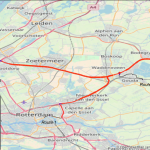
De toenemende beschikbaarheid van nieuwe (big) databronnen en data sciences methoden opent mogelijkheden om op een alternatieve manier verplaatsingsgedrag in termen van herkomst en bestemming, verplaatsingsmotief en routekeuze te analyseren. Dit onderzoeksproject heeft verkend in hoeverre het mogelijk is om floating car data te gebruiken om analyses naar de betrouwbaarheid...Read More »
The Waterstaatskaart, a unique historical data source for the Dutch Water System
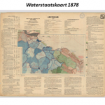
Researchers from the Spatial Information Laboratory (SPINlab) are currently working on a project to explore the possibilities of the Waterstaatskaart, a 19th century map containing all kind of information on the Dutch water system on a national scale. By analysing this historical map and translating the information into digital GIS...Read More »
Geocraft 2017
A lively academic debate exists on the use of games in formal education. Pedagogic/cognitive sciences promote the use of games in class, because these instructional media are considered to have positive effects on affective and cognitive learning. However, according to multiple, very recent systematic literature reviews of Digital Game Based...Read More »
Inzet Geodesign voor Ruimtelijke Prioritering van onderhoud aan (vaar)wegen
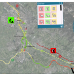
Op verzoek van Rijkswaterstaat Oost Nederland is in maart dit jaar gestart met het project Geodesign voor Ruimtelijke Prioritering van Onderhoud aan Wegen en Vaarwegen. In dit project wordt nagegaan of geodesign een zinvolle bijdrage kan leveren aan de ruimtelijke prioritering van het onderhoud van sluizen, bruggen en (vaar)wegen. In...Read More »
Strategische Verkenning Geodesign
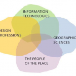
Een extra dimensie voor ruimtelijke informatie met geodesign
De hoeveelheid aanwezige data bij Rijkswaterstaat (RWS) is enorm. Het is belangrijk om deze informatie zodanig te ontsluiten dat er binnen de planvorming optimaal gebruik van kan worden gemaakt. Een goede kaartafbeelding is een belangrijke eerste stap voor het gebruik van ruimtelijke informatie...Read More »