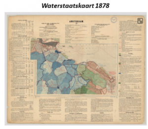
Researchers from the Spatial Information Laboratory (SPINlab) are currently working on a project to explore the possibilities of the Waterstaatskaart, a 19th century map containing all kind of information on the Dutch water system on a national scale. By analysing this historical map and translating the information into digital GIS layers, this unique historical source is usable for spatial digital humanities researchers and heritage and water managers.
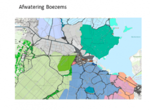
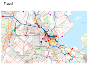
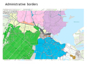
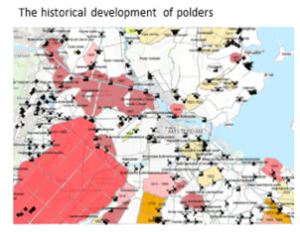
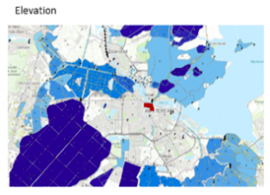
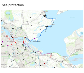
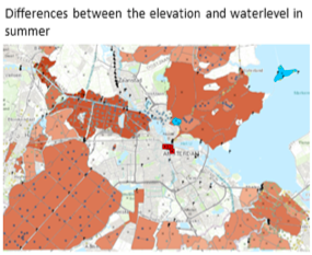
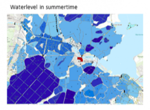
The Waterstaatskaart comprises 183 maps with accompanying textual description of the hydrological system of the polder landscape. The map covers the entire territory of the Netherlands and was produced by Rijkswaterstaat during the second half of the nineteenth century to support spatial decision making. Today, the Waterstaatskaart is a crucial source for understanding the historical hydrological structure. This can be useful, for example, to historians, archaeologists or historical geographers interested in historical transformation of the landscape. Furthermore, it can inform the reuse, adaptation or reintroduction of (aspects of) the water system to tackle current water management problems. To this end, Rijkswaterstaat and the Cultural Heritage Agency of the Netherlands have asked the SPINlab to develop a data model that integrates the maps and the textual information. As a pilot, the information for the area of Amsterdam and its surrounding has been digitized. Based on this dataset, various thematic maps have been extracted, giving a unique insight into the 19th century Dutch water system (figure 1).
Now that we have digitized the historical map for a case study area – using 21st century technologies – we are exploring the use of this information source for present day heritage planning challenges.
For more information please contact Maurice de Kleijn (mtm.de.kleijn@vu.nl ) or dr. Niels van Manen (n.van.manen@vu.nl) .