The analysis and simulation of land-use change has long been the topic of intensive research at the Vrije Universiteit Amsterdam.
Current efforts focus on:
- Analysis of trends and driving forces in past land use changes. Past projects include the explanation of land-use patterns and land prices through statistical (regression) analysis to underpin the development of land-use models within Europe or in other regions in the world. Currently we are involved in the analysis of property prices and land values c.q. empirical bid rents, see www.landvalues.nl for more information. With these analyses we aim to shed more light on the valuation of amenities and the explanation of (spatial) factors that determine the market price of residential land use.
- Simulation of future land use. We participate in various projects to further develop the Land Use Scanner model and continue to apply it in several scenario-based studies, for example related to climate change or agriculture. Validation of the model is the latest research priority.
- Impact assessment of anticipated land use changes. The ultimate goal of most simulation studies of future land use is to inform policymakers on the possible future state of several policy related issues. We assist this evaluation of policy themes with the development and application of indicators of land use change, related to for example the fragmentation of open space, the concentration of urbanisation and flood risk assessment.
Updates
Future land use mapped to assess upcoming water challenges

Water and spatial policy need to be better coordinated to prepare for upcoming climatic and societal changes. We are proud to have provided the land-use scenarios for this important policy advice presented by Deltares to the Minister of Infrastructure and Water Management. This study assesses the water challenges of...Read More »
Understanding the barriers for 15-minute cities
The new ENHANCE project aims to improve urban travel sustainability and equity by understanding current barriers for the application of 15-minute city (15mC) principles in outer metropolitan areas and small cities. Based on this understanding the project will propose strategies to overcome current obstacles in achieving more sustainable and equitable...Read More »
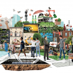
Where to build our houses?
Stel nu dat we bodem en water echt serieus nemen bij de inrichting van Nederland zoals de overheid beoogt? Voor Follow the Money heeft het SPINlab gekeken wat geschikte plekken voor woningbouw zijn. Een paar simpele uitgangspunten staan daarbij centraal: de circa 1 miljoen extra woningen die we denken nodig...Read More »
PhD defense Filipe Batista e Silva
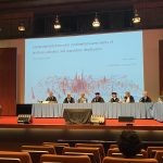
On the 2nd of June 2022, Filipe Batista e Silva successfully defended his PhD dissertation at VU Amsterdam. The thesis, titled Geospatial data fusion for continental assessments of land use, activities and population distribution, proposes an advanced approach for fusing data from conventional and unconventional sources and formats as a...Read More »
Vasco Diogo defends his PhD
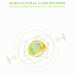
On October 12, Vasco Diogo has successfully defended his PhD dissertation at the VU University. His thesis ‘Agricultural land systems: Explaining and simulating agricultural land-use patterns’ reveals to what extent empirical and theory-based approaches of spatial analysis and land-use modelling are able to explain observed spatial patterns in agricultural land...Read More »