Visualisation of a changed Netherlands in 2030
In the framework of the programme on Environmental Quality of Green Areas the project Nederlands 2030 was launched by the Dutch government to discuss the spatial planning concepts for 2010 -2030.
Since 1991, when the Memorandum Fourth National Spatial Planning Extra was brought out, the Dutch socio-cultural patterns and socio-economic circumstances have changed. There are also doubts whether the building task after 2010 can be realised within current planning concepts. The project Nederlands 2030 was therefore set up to scrutinize existing starting-points and planning concepts and discuss alternative planning solutions.
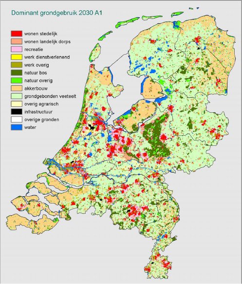
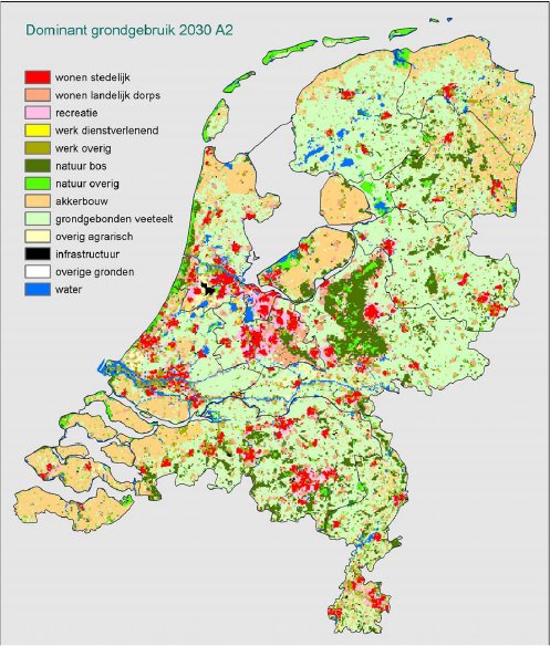
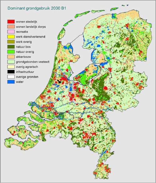
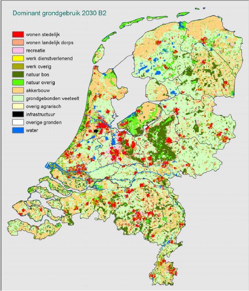
This report describes simulation of the four planning perspectives (Country of Cities, Netherlands Landscape Parc, Country of Flows and Netherlands Palette) derived from the Nederlands 2030 project. Starting-points are the present land use and the expected increase in built-up area (residential and working areas) up to 2030. The result is a collection of maps that show the land use in 2030 according to the four new planning perspectives. These maps are used to determine the effect of the planning perspectives on the mobility.
Start: 2003
Finished: March 2004
Publications related to Netherlands 2030
Borsboom-van Beurden, J.A.M., Boersma, W.T., Bouwman, A.A., Crommentuijn, L.E.M., Dekkers, J.E.C., Koomen, E., Ruimtelijke Beelden – Visualisatie van een veranderd Nederland in 2030, RIVM rapport, 550016003, Bilthoven, 2005.
Remarks: There are two links: one to the report (RIVM) and one to a newspaper article related to the report
Dekkers, J.E.C., Grondprijzen, geschiktheidskaarten en instelling van parameters in het ruimtegebruiksimulatiemodel Ruimtescanner – Technisch achtergrondrapport bij het Project Ruimtelijke Beelden, MNP rapport, 550016005, Bilthoven, 2005.