The lab carries out research in the domain of geo-information science and spatial information management. We apply a wide range of spatial analysis methods and techniques in relation to many different scientific and societal topics. Spatial analysis aims to transform spatial data into meaningful information. In the context of decision making this means the provision of information that helps decision makers in preparing, developing and evaluating alternatives. The spatial analysis process is characterised by a number of subsequent phases that differ in the degree of understanding that is involved. Since the final evaluation or monitoring phase may provide information that is useful for the preceding phases the whole process is considered to be iterative.
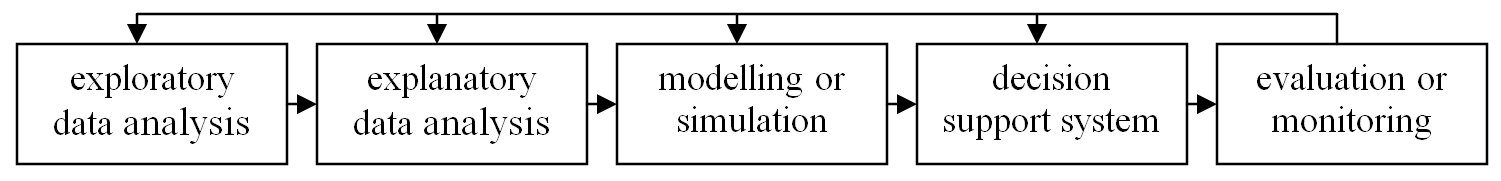
The iterative spatial analysis process (source Koomen, 2008)
SPINlab carries out methodological and applied research in each of the phases of the spatial analysis process. Our projects in this research theme can be further divided under five headings:
- Climate Adaptation
- Spatial Planning
- Land-Use Modelling
- Research involving the Land Use Scanner model
- Location Value
Updates
Understanding the barriers for 15-minute cities
The new ENHANCE project aims to improve urban travel sustainability and equity by understanding current barriers for the application of 15-minute city (15mC) principles in outer metropolitan areas and small cities. Based on this understanding the project will propose strategies to overcome current obstacles in achieving more sustainable and equitable...Read More »
Where to build our houses?
Stel nu dat we bodem en water echt serieus nemen bij de inrichting van Nederland zoals de overheid beoogt? Voor Follow the Money heeft het SPINlab gekeken wat geschikte plekken voor woningbouw zijn. Een paar simpele uitgangspunten staan daarbij centraal: de circa 1 miljoen extra woningen die we denken nodig...Read More »