The SPINlab provides advice and services to researchers of various disciplines at the Vrije Universiteit Amsterdam on all matters related to spatial data and spatial analysis. The lab, furthermore, stimulates industry-academia initiatives and other interactions with societal partners such as governmental organisations and secondary schools (see, for example, the EduGIS-project).
Basically, our GIS tech support comes down to the following categories:
- Spatial Data & Analysis
- Spatial analysis requires spatial data. Geoplaza is VU’s gateway to a number of spatial data sets. That website also provides examples of GIS-related projects and info on software.
- GIS software
- Several software packages are available to visualize and analyse spatial data. In most courses, we apply QGIS, which can be downloaded from https://www.qgis.org/. It is highly recommended you select the latest stable release. VU also has a license for ArcGIS developed by ESRI. You can request a license and find more info on GIS software here: https://geoplaza.vu.nl/en/cms/software/.
- Tools & Models
- You can find some tools on our website.
Updates
Update free BAG-Geocoding tool released
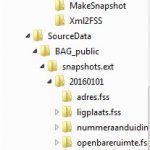
SPINlab, together with Object Vision BV, has released an updated version of their BAG-Geocoding tool. With the GeoDMS-BAG geocoding configuration, you can make snapshots from and geocode against the Dutch Basic Administration of Addresses and Buildings (BAG) on your own computer, for free.
The following issues...Read More »
Free Geocoding tool for Dutch addresses available
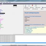
The SPINlab is proud to present a free geocoding tool. It can be used to attach X,Y-coordinates to Dutch addresses and uses the Dutch Basic Administration of Addresses and Buildings (BAG) as it’s geocoding source.
Using an open source GIS-platform (GeoDMS), which is a small but powerful piece of software, the...Read More »
Dataset Ruimtelijke Economie: zonering van Nederland
In EASY is nu de dataset ‘Randstad, Intermediate and Peripheral Zonation’ beschikbaar. Deze bestanden, gedeponeerd door het Spatial Information laboratory van de VU, beschrijven de zonering van Nederland in 3 gebieden, gebaseerd op een publicatie van Wagtendonk en Rietveld over ruimtelijke ordening en woningbouw.
De dataset is beschikbaar gesteld door de...Read More »
UBVU and SPINlab relaunch the Geoplaza Spatial Data Portal
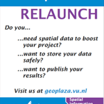
The University Library (UBVU) together with the Spatial Information Laboratory (SPINlab) have redesigned and upgraded the Geoplaza Spatial Data Portal. VU Geoplaza is the portal for all matters related to GIS (Geographical Information Systems) and geodata at the VU University Amsterdam. It gives a platform for students and employers that...Read More »
The VU is the first university in the Netherlands to have access to Bridgis’ Populator Data Service
The SPINlab of VU University Amsterdam has reached an agreement with Bridgis about their Populator online information service, ensuring access for research and education purposes to this rich online data environment. The VU University is the first university in the Netherlands to have this access.
With the Populator service, staff &...Read More »