A small SPINlab delegation visited the Organisation for Economic Cooperation and Development (OECD) in Paris last week to present a land-use data inventory to delegation members from across the globe. The report for this meeting was prepared by Vasco Diogo,
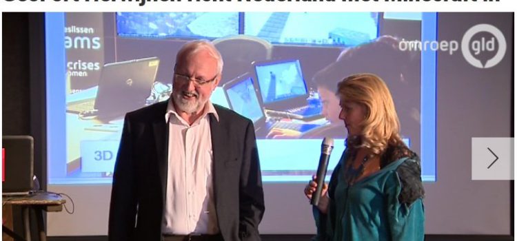
Minecraftprofessor richt Nederland in met Minecraft

HERWIJNEN – Heel Nederland nabouwen in de virtuele werkelijkheid, dat start vandaag in het GeoFort in Herwijnen. Het landelijke Minecraftproject is het initiatief van het GeoFort. Met behulp van echte gegevens van het Kadaster en Rijkswaterstaat kan iedereen vanaf vanmiddag
Minecraft planning op Zeeburgereiland
Zeeburgereiland (Amsterdam) is volop in ontwikkeling. De eerste bewoners zijn reeds gearriveerd. De eerste tijdelijke initiatieven krijgen langzaam maar zeker vorm. De bewoners van Nautilus denken na over een buurtpark, een drietal bewoners hebben zich verenigd en bouwen aan een
Open Seminar Series Geoscience & Remote Sensing
Introducing a SuperGPS network You are kindly invited to the Open Seminar Series lecture: ‘Accurate positioning, timing and relativistic geodesy through optical clocks and telecommunication networks, by Jeroen Koelemij. Read more…
You can now register for another interesting UNIGIS Amsterdam Expert Webinar on Linked Data & Location Intelligence
How to create innovative applications with Linked Data and Location Intelligence? Our three experts on Linked Data & Geo will illustrate their visions and experience. Erwin Folmer kicks of this webinar with an overview of the concept of Linked Data
UNIGIS Amsterdam presents: Expert Webinars open to all
UNIGIS Amsterdam presents a series of Expert Webinars that are open to anyone interested in the particular topics presented. The first webinar scheduled on Wednesday April 8 at 5 pm (CET) is about the fascinating topic of Sensor Web &
EC-JRC meeting on integrated territorial policy assessment
The Joint Research Centre of the European Commission (EC-JRC) invited a large delegation of SPINlab to contribute to their international workshop on integrated territorial policy assessment in Ispra, Italy. Together with, amongst others, researchers from the JRC units in Seville
Project Mozambique
Project Mozambique: A pictorial approach to geodesign: a case study for the Lower Zambezi valley In a recent project the SPINlab Geodesign team has applied it’s experience with geodesign in data rich environments such as the Netherlands and the UK
eScience team collaboration on Via Appia point cloud
Last week NLeSC´s complete team of eScience Research Engineers, together with archaeologists and historians of the Via Appia project, collaborated for three days in a row on building a point cloud 3D Geographic Information System for the archaeological study area
VU-PBL onderzoek naar de economische vitaliteit van kleine kernen in ESB

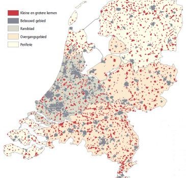
Regelmatig wordt bericht over toenemende tegenstellingen tussen groeiende steden en leeglopende dorpen. In werkelijkheid blijkt dit een stuk genuanceerder te liggen. In sommige kleine kernen groeit de werkgelegenheid relatief sneller dan het nationaal gemiddelde. Ook demografisch ontwikkelen deze kleine kernen
