Skip to content
SPINlab Vrije Universiteit Amsterdam

SPINlab Vrije Universiteit Amsterdam

Spatial Information laboratory

Menu

  • Home
  • Research
    • Accessibility
    • Spatial Analysis & Modelling
      • Land Use Modelling
        • Land Use Scanner model
        • Land Use Scanner – Student Edition
      • Climate Adaptation
      • Spatial Planning
      • Location value
    • GeoDesign
      • Wastecosmart
    • Tools & Models
      • Definite / BOSDA
      • GeoDMS BAG-Geocoder
    • Research archive
      • Risk Management
        • RWS 3D Linked Data Viewer
        • GDI4DM
      • Spatial Digital Humanities
        • 3D GIS Via Appia
        • Archaeological Information System
        • CLUE
        • EUWATHER
        • Rediscovering Testaccio
        • Rediscovering landscape
        • citivu.nl
      • GeoServices 4 Sustainability
  • Education
    • UNIGIS Distance-learning MSc. in GIS
    • Supervised theses
  • Support
  • Publications
    • ISAAC
    • PhD dissertations
    • Land Use Scanner publications
  • News & Agenda
  • About
    • Staff
    • Partners
      • PBL
      • RWS
    • Contact

Support

Update free BAG-Geocoding tool released

SPINlab, together with Object Vision BV, has released an updated version of their BAG-Geocoding tool. With the GeoDMS-BAG geocoding configuration, you can make snapshots from and geocode against the Dutch Basic Administration of Addresses and Buildings (BAG) on your own computer,

Maurice de Kleijn 16th March 201726th June 2023 Support Read more

Free Geocoding tool for Dutch addresses available
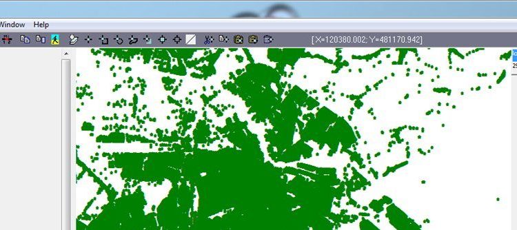
Free Geocoding tool for Dutch addresses available

The SPINlab is proud to present a free geocoding tool. It can be used to attach X,Y-coordinates to Dutch addresses and uses the Dutch Basic Administration of Addresses and Buildings (BAG) as it’s geocoding source. Using an open source GIS-platform

Maurice de Kleijn 16th September 2016 Research, Support Read more

Dataset Ruimtelijke Economie: zonering van Nederland

In EASY is nu de dataset ‘Randstad, Intermediate and Peripheral Zonation’ beschikbaar. Deze bestanden, gedeponeerd door het Spatial Information laboratory van de VU, beschrijven de zonering van Nederland in 3 gebieden, gebaseerd op een publicatie van Wagtendonk en Rietveld over

Maurice de Kleijn 25th February 201429th June 2016 Support No Comments Read more

UBVU and SPINlab relaunch the Geoplaza Spatial Data Portal

The University Library (UBVU) together with the Spatial Information Laboratory (SPINlab) have redesigned and upgraded the Geoplaza Spatial Data Portal. VU Geoplaza is the portal for all matters related to GIS (Geographical Information Systems) and geodata at the VU University

Maurice de Kleijn 3rd December 20138th November 2018 Support No Comments Read more

The VU is the first university in the Netherlands to have access to Bridgis’ Populator Data Service

The SPINlab of VU University Amsterdam has reached an agreement with Bridgis about their Populator online information service, ensuring access for research and education purposes to this rich online data environment. The VU University is the first university in the

Maurice de Kleijn 25th November 20138th November 2018 Support No Comments Read more

Geoplaza UBVU-SPINlab genomineerd voor Nederlands Dataprijs DANS-KNAW

Uit 40 inzendingen zijn drie datasets genomineerd voor de Nederlandse Dataprijs voor humaniora en sociale wetenschappen, jaarlijks uitgereikt door DANS-KNAW. Het Geoplaza dataportaal van de Vrije Universiteit Amsterdam is een van de drie genomineerden “De drie genomineerde datasets hebben stuk

Maurice de Kleijn 5th October 201229th June 2016 Support No Comments Read more

Geoplaza UBVU now officially opened

The Geoplaza, a combined effort from UBVU and SPINlab, is officialy on-line. This Spatial Data Infrastructure offers a growing collection spatial data. Everyone can view the data, in most cases download functionality is limited to VU staff and students only.

Maurice de Kleijn 11th November 201129th June 2016 Support No Comments Read more

Latest updates

  • Vulnerable areas prone to urban development 1st July 2024
  • Future land use mapped to assess upcoming water challenges 24th April 2024
  • Understanding the barriers for 15-minute cities 18th October 2023
  • Twinning for climate-resilient urban solutions 12th June 2023
  • Where to build our houses? 18th April 2023
Copyright © 2025 SPINlab Vrije Universiteit Amsterdam. All rights reserved. Theme Spacious by ThemeGrill. Powered by: WordPress.
  • Disclaimer
  • Cookie & Privacy Policy