Text about using GIS for Risk & Crisis management
Updates
Europe’s population density patterns mapped in Nature Communications
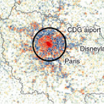
Filipe Batista e Silva is a PhD candidate at SPINlab working for the European Union’s Joint Research Centre. Over the past years he worked on uncovering temporal changes in Europe’s population density patterns using a data fusion approach. He combines official statistics with geospatial data from emerging sources to produce...Read More »
Famine Action Mechanism

PhD candidate Bo Andrée is working on an ambitious high profile project at the World Bank: the Famine Action Mechanism (FAM). This project seeks to monitor and detect early signs of famine risk and link forecasts to prearranged and agreed financing and intervention plans to respond earlier and consistently...Read More »
Succesful PhD Defense Panayiotis Sophronides
On October 7, our SPINlab-colleague Panayiotis Sophronides has successfully defended his PhD dissertation at the National Technical University of Athens. His thesis is entitled ‘Decision Support Systems for Participatory Flood Risk and Disaster Management’ and purports to critically review the existing knowledge and to identify and propose innovative solutions towards...Read More »