During 2017 and 2018, the World Bank with the support from Spinlab researchers Eric Koomen and Eduardo Dias carried out the project entitled: “A National GIS-Based Cultural Landscape Database for Large Infrastructure Planning and Development in Bhutan”. This project is part of the World Bank support to the Royal Government of Bhutan on the domain on culture for development.
The project supported the creation of a comprehensive repository of heritage data to inform the integration of cultural landscape considerations in large infrastructure planning in Bhutan. Results of the project include a) an assessment of the availability of data on cultural heritage and landscapes; b) an initial analysis of landscape changes affecting heritage; and c) recommendations for enhancing the presentation of cultural landscape data. For the latter, the team developed a framework for analysis and tools aiming to contribute to further valuing, supplementing and disseminating the existing cultural data sets for the purposes of long-term sustainable development planning and heritage stewardship.
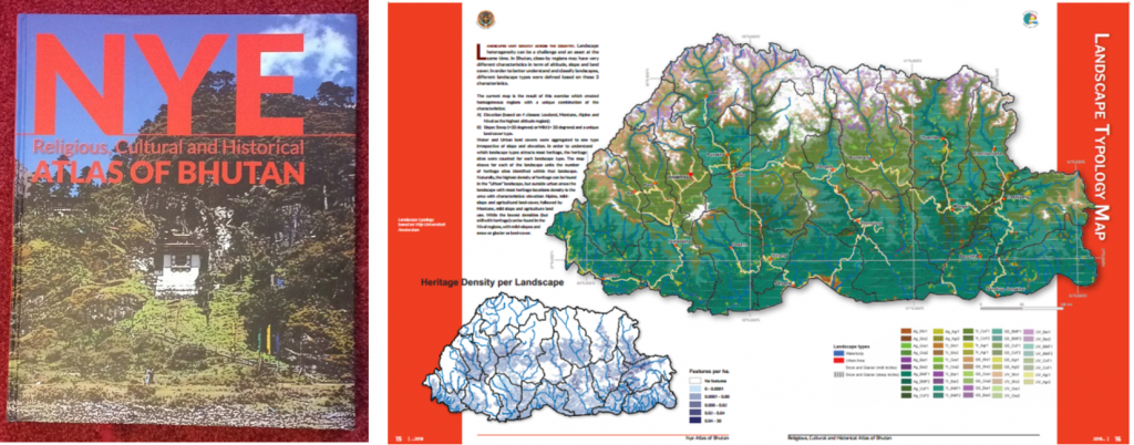
Some of the of the landscape mapping methodologies developed in this project are featured in the recently launched Nye Atlas of Bhutan in cooperation with cartographer Wim Feringa (University of Twente). This authoritative Atlas, published by the Bhutan National Mapping agency (NLCS), intends to be a comprehensive inventory of Bhutanese heritage and in this way support its management.
The project was also the subject of Thomas Warnaar’s Master Thesis “Landscapes of the Thunder Dragon, Creating a Typology of Bhutanese Landscapes as a tool for Policy-makers and Researchers”(link). As part of this thesis Thomas developed the first ever cultural landscape characterization for Bhutan.