Skip to content
SPINlab Vrije Universiteit Amsterdam

SPINlab Vrije Universiteit Amsterdam

Spatial Information laboratory

Menu

  • Home
  • Research
    • Accessibility
    • Spatial Analysis & Modelling
      • Land Use Modelling
        • Land Use Scanner model
        • Land Use Scanner – Student Edition
      • Climate Adaptation
      • Spatial Planning
      • Location value
    • GeoDesign
      • Wastecosmart
    • Tools & Models
      • Definite / BOSDA
      • GeoDMS BAG-Geocoder
    • Research archive
      • Risk Management
        • RWS 3D Linked Data Viewer
        • GDI4DM
      • Spatial Digital Humanities
        • 3D GIS Via Appia
        • Archaeological Information System
        • CLUE
        • EUWATHER
        • Rediscovering Testaccio
        • Rediscovering landscape
        • citivu.nl
      • GeoServices 4 Sustainability
  • Education
    • UNIGIS Distance-learning MSc. in GIS
    • Supervised theses
  • Support
  • Publications
    • ISAAC
    • PhD dissertations
    • Land Use Scanner publications
  • News & Agenda
  • About
    • Staff
    • Partners
      • PBL
      • RWS
    • Contact

Research

Vulnerable areas prone to urban development

Vulnerable areas prone to urban development

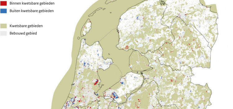
Around 40% of future urban development in the Netherlands is likely to take place within vulnerable areas. The development of new houses, industrial estates and holiday homes until 2050 may affect large areas with natural, landscape or cultural values. The

Eric Koomen 1st July 20241st August 2024 Land-Use Modelling, News, PhD research Jip, Research, Spatial Planning, Sustainable Urban Development Read more

Future land use mapped to assess upcoming water challenges

Future land use mapped to assess upcoming water challenges

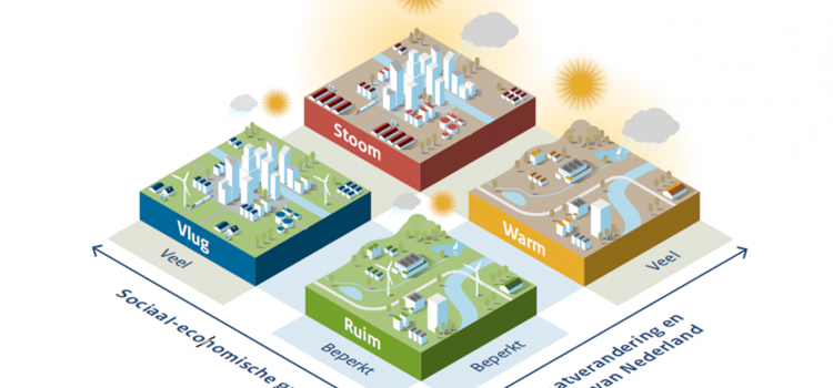
Water and spatial policy need to be better coordinated to prepare for upcoming climatic and societal changes. We are proud to have provided the land-use scenarios for this important policy advice presented by Deltares to the Minister of Infrastructure and

Eric Koomen 24th April 202415th May 2024 Land Use Scanner, Land-Use Modelling, Spatial Planning, Uncategorised Read more

Understanding the barriers for 15-minute cities

Understanding the barriers for 15-minute cities

The new ENHANCE project aims to improve urban travel sustainability and equity by understanding current barriers for the application of 15-minute city (15mC) principles in outer metropolitan areas and small cities. Based on this understanding the project will propose strategies

Eric Koomen 18th October 202318th October 2023 Accessibility, Land-Use Modelling, Spatial analysis and modelling, Sustainable Urban Development, Uncategorised Read more

Twinning for climate-resilient urban solutions

Twinning for climate-resilient urban solutions

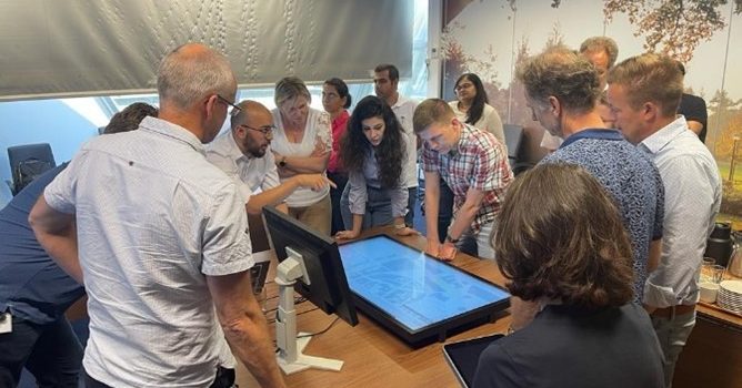
University of Twente and Vrije Universiteit cooperated in a project to explore the potential of digital twins for developing sustainable, climate-resilient urban development strategies. Digital twins offer a realistic representation of the built environment based on a variety of spatial

Eric Koomen 12th June 202318th October 2023 Climate change, Education, Geodesign, Sustainable Urban Development Read more

Where to build our houses?

Stel nu dat we bodem en water echt serieus nemen bij de inrichting van Nederland zoals de overheid beoogt? Voor Follow the Money heeft het SPINlab gekeken wat geschikte plekken voor woningbouw zijn. Een paar simpele uitgangspunten staan daarbij centraal:

Jip Claassens 18th April 202326th June 2023 Land Use Scanner, Land-Use Modelling, Research, Spatial analysis and modelling Read more

Digital twin Alkmaar

Als eerste stop op haar digitaliseringstour, deed de Staatssecretaris voor Koninkrijksrelaties en Digitalisering de gemeente Alkmaar aan. Tijdens dit werkbezoek werd de digital twin van Alkmaar officieel opengesteld. Als onderdeel van het inhoudelijk programma mocht de VU kort vertellen over recent mobiliteitsonderzoek

Jip Claassens 16th September 202223rd June 2023 Geodesign, Research Read more

Floating car data reveals travel time reliability

Data obtained from in-car navigation software, traffic apps and fleet management software is a valuable new asset to describe mobility. Such floating car data holds great promise for a more detailed description of mobility patterns and a deeper understanding of

Jip Claassens 5th September 202223rd June 2023 Accessibility, Research Read more

Spatial data science en mobiliteit

Mobiliteit is een van de drie grote maatschappelijke vraagstukken van dit moment. In het college/webinar van Data Science Alkmaar gisteren, gaven drie sprekers aan hoe we met ruimtelijke data & machine learning technieken diverse verkeersaspecten steeds beter in beeld krijgen.

Jip Claassens 24th June 202223rd June 2023 Accessibility, Research, Spatial analysis Read more

PhD defense Filipe Batista e Silva

On the 2nd of June 2022, Filipe Batista e Silva successfully defended his PhD dissertation at VU Amsterdam. The thesis, titled Geospatial data fusion for continental assessments of land use, activities and population distribution, proposes an advanced approach for fusing

Jip Claassens 2nd June 202226th June 2023 Land-Use Modelling, News, PhD Research, Research, Seminars Read more

Webinar digital twins

Digital twin is het nieuwe buzzwoord in de wereld van data en AI. Maar: wat is het? Een digital twin is een virtuele representatie van een fysieke situatie of product. Het dynamisch meten vormt een belangrijk onderdeel van een DT

Jip Claassens 17th June 202126th June 2023 Geodesign, News, Research, Seminars Read more
  • « Previous

Latest updates

  • Vulnerable areas prone to urban development 1st July 2024
  • Future land use mapped to assess upcoming water challenges 24th April 2024
  • Understanding the barriers for 15-minute cities 18th October 2023
  • Twinning for climate-resilient urban solutions 12th June 2023
  • Where to build our houses? 18th April 2023
Copyright © 2025 SPINlab Vrije Universiteit Amsterdam. All rights reserved. Theme Spacious by ThemeGrill. Powered by: WordPress.
  • Disclaimer
  • Cookie & Privacy Policy