On the 2nd of June 2022, Filipe Batista e Silva successfully defended his PhD dissertation at VU Amsterdam. The thesis, titled Geospatial data fusion for continental assessments of land use, activities and population distribution, proposes an advanced approach for fusing
Webinar digital twins
Digital twin is het nieuwe buzzwoord in de wereld van data en AI. Maar: wat is het? Een digital twin is een virtuele representatie van een fysieke situatie of product. Het dynamisch meten vormt een belangrijk onderdeel van een DT
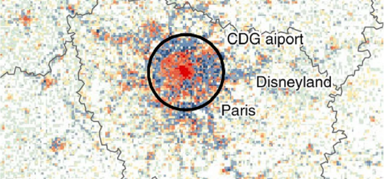
Europe’s population density patterns mapped in Nature Communications

Filipe Batista e Silva is a PhD candidate at SPINlab working for the European Union’s Joint Research Centre. Over the past years he worked on uncovering temporal changes in Europe’s population density patterns using a data fusion approach. He combines
Theory and Application of Dynamic Spatial Time Series Models
Today Bo Andrée defended his PhD dissertation in an online session that had a live stream on YouTube. The somewhat impersonal, digital setting did not inhibit a lively discussion. Bo’s thesis sets out to develop theory and methods to analyze
Relation between air pollution and confirmed COVID-19 cases researched
SPINlab doctoral candidate Bo Andree recently led a study on the relationship between air pollution and COVID-19 incidences in the Netherlands for The World Bank. With the spread of the virus several hotspots emerged around the globe, a number of which coincided
Voor een appartement wordt meer betaald
Dat kopte de NRC op 27 april over een onderzoek dat mede is uitgevoerd door SPINlab onderzoekers Jip Claassens en Bart Rijken. In dit onderzoek werd een vergelijking gemaakt tussen de bereidheid om te betalen voor binnenstedelijke appartementen en suburbane
3D archeologie in Rome
Spinlab onderzoeker Maurice de Kleijn (geospatiaal archeoloog (PhD), en Rens de Hond (promovendus-archeoloog, 3D-specialist) hebben in de afgelopen maanden bijgedragen aan de tentoonstelling Via Appia Revisited. Tijdreizen over de Eeuwige Snelweg. Deze tentoonstelling is een tijdreis langs de beroemde antieke
PhD promotion Ting Zou
Last January Ting Zou successfully defended her PhD dissertation at the VU University. Her thesis Landscape service provisions and preferences on the urban–rural fringe ‘attempts to investigate changes in landscape service supply and people’s preferences towards these services over space
Space for Employment
SPINlab started a new research project on focussed on the transformation and expansion of formal business estates (bedrijventerreinen) with several societal partners. The new ‘ruimte voor werken’ (space for employment) project has been granted by NWO as part of the
Spinlab research featured in the Bhutanese Cultural Atlas
During 2017 and 2018, the World Bank with the support from Spinlab researchers Eric Koomen and Eduardo Dias carried out the project entitled: “A National GIS-Based Cultural Landscape Database for Large Infrastructure Planning and Development in Bhutan”. This project is part of the World Bank
