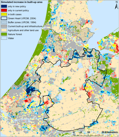
Spatial planning relates to policy interventions that aim to steer spatial developments in such a way that societal and environmental conditions are improving, whilst also meeting other objectives related to, for example, economic development, water management and biodiversity conservation. Reconciling these often conflicting objectives is an extremely demanding task that calls for: clear undisputed information on current developments; insight in possible future trends; the preparation of alternative policy measures and an understanding of their impact. Spatial analysis can provide the required information on past, current and projected spatial developments as well as indicate the impact of existing and proposed policy measures as is demonstrated in this thesis. See the figure on this page as an example of an analysis result (Source: Koomen and Dekkers, 2013).
SPINlab combines various forms of spatial analysis with newly available and highly detailed spatial data sets in research that supports the formulation of spatial polices in domains such as:
- open space preservation
- rural vitality
- urban intensification
- sustainable urban development
- attracting knowledge workers
Updates
Space for Employment
SPINlab started a new research project on focussed on the transformation and expansion of formal business estates (bedrijventerreinen) with several societal partners.
The new ‘ruimte voor werken’ (space for employment) project has been granted by NWO as part of the VerDuS SURF Pop Up 2019 programme. The demand for residences and...Read More »
Urban densification session at RSA conference

VU-SPINlab organized a special session on urban densification at the Regional Studies Association’s winter conference in London last week. The central question was: Are cities dense enough? Several speakers from universities and the European Commission addressed this question, explaining regional variation in urban growth in Europe, proposing model approaches...Read More »
Urban sprawl report OECD
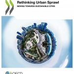
One of our alumni (Lara Engelfriet) contributed to an extensive urban sprawl study while working at the OECD. Using highly detailed spatial data the study quantifies the multiple dimensions of urban sprawl in a new set of indicators. The outcomes provide a new perspective to the nature of urban sprawl...Read More »
Floating car data bruikbaar voor de analyse van deur-tot-deur reistijdbetrouwbaarheid
De toenemende beschikbaarheid van nieuwe (big) databronnen en data sciences methoden opent mogelijkheden om op een alternatieve manier verplaatsingsgedrag in termen van herkomst en bestemming, verplaatsingsmotief en routekeuze te analyseren. Dit onderzoeksproject heeft verkend in hoeverre het mogelijk is om floating car data te gebruiken om analyses naar de betrouwbaarheid...Read More »
Spatial and Financial Feasibility of Further Urban Densification to be investigated by SPINlab

The Netherlands Organisation for Scientific Research (NWO) has granted three research proposals in the SURF Pop Up 2016 tender. One of them concerns the feasibility of further urban densification. This proposal has been...Read More »