Skip to content
SPINlab Vrije Universiteit Amsterdam

SPINlab Vrije Universiteit Amsterdam

Spatial Information laboratory

Menu

  • Home
  • Research
    • Accessibility
    • Spatial Analysis & Modelling
      • Land Use Modelling
        • Land Use Scanner model
        • Land Use Scanner – Student Edition
      • Climate Adaptation
      • Spatial Planning
      • Location value
    • GeoDesign
      • Wastecosmart
    • Tools & Models
      • Definite / BOSDA
      • GeoDMS BAG-Geocoder
    • Research archive
      • Risk Management
        • RWS 3D Linked Data Viewer
        • GDI4DM
      • Spatial Digital Humanities
        • 3D GIS Via Appia
        • Archaeological Information System
        • CLUE
        • EUWATHER
        • Rediscovering Testaccio
        • Rediscovering landscape
        • citivu.nl
      • GeoServices 4 Sustainability
  • Education
    • UNIGIS Distance-learning MSc. in GIS
    • Supervised theses
  • Support
  • Publications
    • ISAAC
    • PhD dissertations
    • Land Use Scanner publications
  • News & Agenda
  • About
    • Staff
    • Partners
      • PBL
      • RWS
    • Contact

land-use modelling

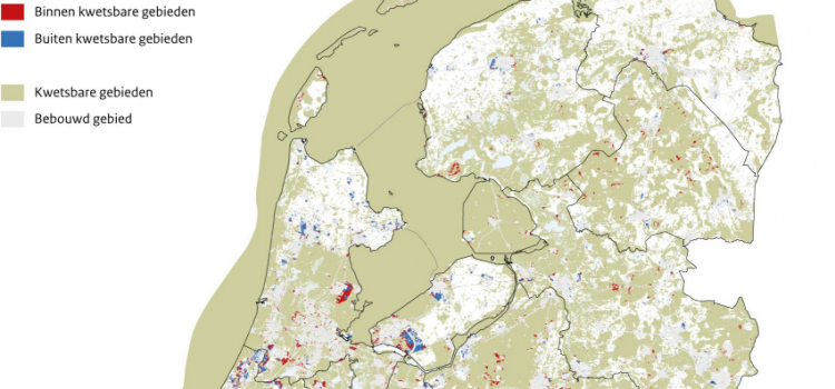
Vulnerable areas prone to urban development

Vulnerable areas prone to urban development

Around 40% of future urban development in the Netherlands is likely to take place within vulnerable areas. The development of new houses, industrial estates and holiday homes until 2050 may affect large areas with natural, landscape or cultural values. The

Eric Koomen 1st July 20241st August 2024 Land-Use Modelling, News, PhD research Jip, Research, Spatial Planning, Sustainable Urban Development Read more

Future land use mapped to assess upcoming water challenges

Future land use mapped to assess upcoming water challenges

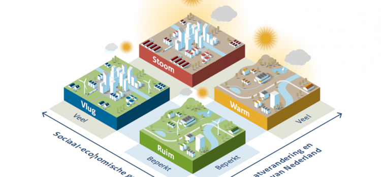
Water and spatial policy need to be better coordinated to prepare for upcoming climatic and societal changes. We are proud to have provided the land-use scenarios for this important policy advice presented by Deltares to the Minister of Infrastructure and

Eric Koomen 24th April 202415th May 2024 Land Use Scanner, Land-Use Modelling, Spatial Planning, Uncategorised Read more

Understanding the barriers for 15-minute cities

Understanding the barriers for 15-minute cities

The new ENHANCE project aims to improve urban travel sustainability and equity by understanding current barriers for the application of 15-minute city (15mC) principles in outer metropolitan areas and small cities. Based on this understanding the project will propose strategies

Eric Koomen 18th October 202318th October 2023 Accessibility, Land-Use Modelling, Spatial analysis and modelling, Sustainable Urban Development, Uncategorised Read more

EC-JRC meeting on integrated territorial policy assessment

The Joint Research Centre of the European Commission (EC-JRC) invited a large delegation of SPINlab to contribute to their international workshop on integrated territorial policy assessment in Ispra, Italy. Together with, amongst others, researchers from the JRC units in Seville

Maurice de Kleijn 3rd March 20158th November 2018 Land-Use Modelling, Spatial Planning No Comments Read more

UNIGIS MSc thesis: The influence of land use change on hydrology

Changes in land use have influence upon hydrology. This influence can been subdivided into direct and indirect influence of changes in land use upon hydrology. Direct influence comprises the influence of changes in land use upon evapotranspiration and degree of

Maurice de Kleijn 17th March 20148th November 2018 Land-Use Modelling, UNIGIS No Comments Read more

Vasco Diogo hits the local Australian news, highlighting the use of a land-use modeling framework to assess the potential for biofuels

PhD researcher Vasco Diogo, who is visiting the University of Melbourne as part of his activities in the Tools for adaptation strategies project, presents his work at the Biofuel Forum in Traralgon, Victoria. He will highlight the use of a

Maurice de Kleijn 19th November 20138th November 2018 Land-Use Modelling, News No Comments Read more

Knowledge for climate – Theme 8: Socio-economic scenarios updated

The updated land-use projections related to the Global Economy (GE) and Regional Communities (RC) scenarios have been released. These scenarios were initially developed by a consortium of Dutch research institutes (CPB et al., 2006) and translated into land-use projections in

Maurice de Kleijn 1st March 20138th November 2018 Land Use Scanner, Land-Use Modelling No Comments Read more

Latest updates

  • Vulnerable areas prone to urban development 1st July 2024
  • Future land use mapped to assess upcoming water challenges 24th April 2024
  • Understanding the barriers for 15-minute cities 18th October 2023
  • Twinning for climate-resilient urban solutions 12th June 2023
  • Where to build our houses? 18th April 2023
Copyright © 2025 SPINlab Vrije Universiteit Amsterdam. All rights reserved. Theme Spacious by ThemeGrill. Powered by: WordPress.
  • Disclaimer
  • Cookie & Privacy Policy